
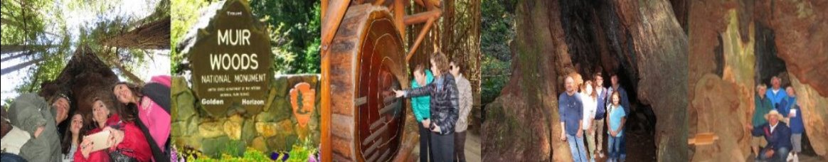
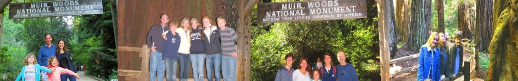
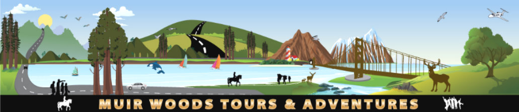
Muir Woods National Monument Things to See
Why should you visit Muir Woods National Monument?
Muir Woods National Monument is home to the famous giant coastal redwoods, the tallest trees on the planet? Did you know that if you were to stack three of these trees together, they would be the same height as the Eiffel Tower in Paris? And if you add one more tree on top of that, it would be as tall as the Empire State Building in New York City!
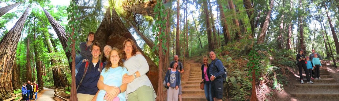
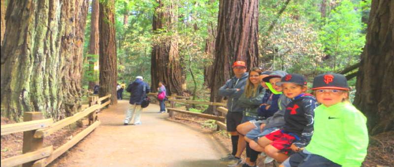
Stroll through the ancient redwood forest and contemplate the serenity of this majestic old grove of redwoods. Walk at your own pace among the towering redwoods and along a winding creek crossed by several bridges. We recommend walking to Bridge 3 and loop around the creek and return to the parking lot unless you want to spend more time hiking in Muir Woods.
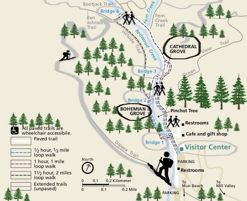
Hiking: Muir Woods has a paved trail which is mostly flat. You can choose between many loops; from half -mile easy loop, one mile, to two miles loop which can be easily achieved in one hour or so depending on your pace. Most trails are rather easy and self-explanatory, and a free detailed map will be giving at you at Muir Woods main entrance when you’ll purchase your entrance tickets. There is an accessible gift shop, café and restroom facility located close to the main entrance by bridge number 1. However, there is no cell signal or wifi available in the woods, and no vehicles can access this steep canyon without having a special permit and advanced reservation.
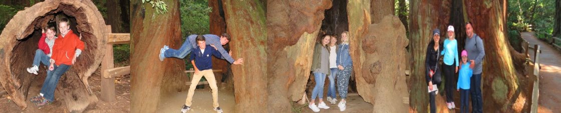
For visitors who can’t talk or hike, there are many large and tall redwoods located by the main entrance and can be seen without even hiking or walking.
Important: Muir Woods has become one of the first national parks to require advanced reservation and parking permits. No one can visit or access Muir Woods anymore without a prior reservation.
Travel Tip: To avoid the crowds and large bus tours in Muir Woods forest of redwoods, we highly recommend visiting Muir Woods as early as 7:30 or 8 am.
Fun fact: Did you know that four of these redwood trees stacked on top of each other would be as tall as the Empire State Building?

Brief history: It was back in 1908 when President Theodore Roosevelt used the powers of the Antiquities Act to create Muir Woods National Monument. William Kent, who donated the land for the monument, requested that it be named for noted conservationist John Muir, considered today as the father founder of the National Park System in the USA.

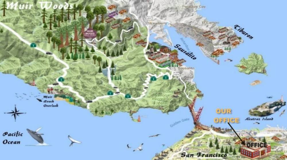
Muir Woods National Monument is part of the National Park Service on Mount Tamalpais near San Francisco, in southwestern Marin County in California. It is part of the Golden Gate National Recreation Area and is 12 miles (19 km) north of San Francisco. It protects 554 acres (224 ha] of which 240 acres (97 ha) are old growth coast redwood (Sequoia sempervirens) forests, one of a few such stands remaining in the San Francisco Bay Area.
Muir Woods National Monument Entrance Fees:
$15.00-Adult (16 years of age and older)
Free-Children (15 years of age and under)
Fourth Graders, Fifth Graders, and Veterans and Gold Star Families can visit for free! Follow the instructions in the link before you arrive at Muir Woods.
Muir Woods National Monument accept payment by cash and credit card
Passes
The following park passes (sold at the Muir Woods Visitor Center!) allow pass holders and up to three other adults to enter Muir Woods free of charge:
Muir Woods Annual Pass $45.00 This pass is good for 12 months. It admits the pass holder and three persons (16 and older) to Muir Woods National Monument in Mill Valley.
America the Beautiful – The National Parks and Federal Recreation Lands Pass admits pass holders and up to three other adults to Muir Woods and all National Parks/Federal Recreation Lands that charge an entrance fee. There are several different versions of this pass:
Annual Pass $80
Active-Duty Military Pass Free
Annual Senior Pass (62+) $20
Lifetime Senior Pass (62+) $80
Access Pass Free
Volunteer Pass Free
Muir Beach Things to Do and Muir Beach Overlook

Muir Woods Beach: Tucked in the foothills of Mount Tamalpais, the charming village of Muir Woods Beach is a romantic and cozy getaway for locals. Muir Beach is a quiet sheltered cove located on the Pacific Coast three miles west of Muir Woods National Monument, between Stinson Beach the Golden Gate Bridge. Muir Beach and lagoon favored by locals. Muir. The beach is accessed over a 450-foot-long pedestrian bridge that connects the parking lot to the beach, the Coastal Trail, and Kaashi Way, which is multi-use and accessible.
Muir Beach Redwood Creek and Lagoon and surrounding riparian area provide critical habitat for coho salmon and red-legged frogs and is closed to all access. Also, every autumn thousands of monarch butterflies (Danaus plexippus) embark on a once-in-a-lifetime migration to the California coast. Wintering monarchs can sometimes be found decorating Monterey pines in the small grove at Muir Beach; look for their distinctive orange and black wings.
There is a small free parking lot at Muir Beach but extremely limited. Large vehicles as well as commercial vehicles are not allowed without permits and advanced reservations. Muir Beach offers one of the most enjoyable hikes and trails in the Marin County with spectacular ocean views of San Francisco and the Ocean. The Pelican Inn at Muir Beach opens its doors to you for the fellowship of its Tudor bar and country cooking.
Muir Beach Overlook: Muir Beach Overlook is rocky point that sits atop rugged steep cliffs overlooking Muir Beach, San Francisco, Bolinas, and Mount Tamalpais. This small park is part of the Golden Gate National Recreation Area located on State Route 1 between Sausalito and Stinson Beach.
Take the short hiking trail to a cliff-top lookout to enjoy a panoramic and sweeping views of the Marin coast, and Muir Beach.
The cliff plunges over 200 feet to the rocky surf. Nearby you can visit Slide Ranch and its animal farm, and below that, a tidal reef loaded with small crabs.
Brief history: Muir Beach overlook observation bunkers were built during the Second World War as part of the American coastal defense of California against the threat of Pacific invasions. This was a military outpost.

Muir Beach Bunkers contain several historic base-end stations. From these stations, soldiers viewed ships and triangulated the distance, speed, and direction of these ships in coordination with different stations. These stations were mostly important for artillery units stationed on the coast to attack any invasion.
They gained particular importance during World War II immediately after the bombing of Pearl Harbor when many in California feared San Francisco or Los Angeles would be the next target. With the advent of radar and its widespread use, these stations became obsolete.
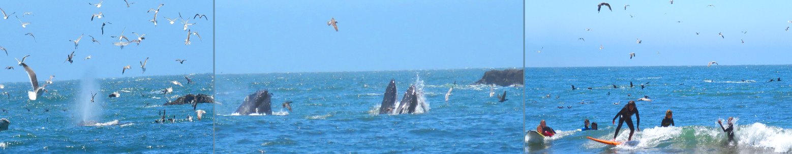
Today, a few of them remain open like ruins where you may enter them to get somewhat of a perspective of the soldiers who were therein stationed.Surf: Bolinas and Stinson Beach are some of the top spots for surfing in Northern California. There are pretty houses perched at the top of the cliff edge above the beach. Whales and harbors seals can be seen nearby.
Top walks and day hikes in and around Muir Woods Forest
| Hike | Round-Trip Distance | Time/ Difficulty Level | Description |
| Main Trail: Bridge 2 and back | 0.5 mi/ 0.8 km | +/- 0.5 hour | Muir Woods’ main trail begins at the National Parks Visitor center and follows Redwood Creek on both sides of the stream. Enjoy views of old growth redwood forest from a stroller and wheelchair accessible boardwalk. |
| Main Trail: Bridge 3 and back | 1 mi/ 1.6 km | +/- 1 hour | Muir Woods’ main trail begins at the National Parks Visitor center and follows Redwood Creek on both sides of the stream. Enjoy views of old growth redwood forest from a stroller and wheelchair accessible boardwalk. |
| Main Trail: Bridge 4 and back on Hillside Trail | 2mi/ 3. 2 km Elevation Gain: 90 ft/ 27 m | +/- 2 hours | Muir Woods’ main trail begins at the National Parks Visitor center and follows Redwood Creek. Continue past Cathedral Grove for 0.5 mV 0. 8 km to Bridge 4. Cross the bridge and walk uphill, then turn left on the Hillside Trail. This dirt path will return you to Bridge 2 and offers a different view of the forest. |
| Canopy View to Lost Creek to Fern Creek Loop | 3 mi/ 4.8 km Elevation Gain: 530 ft/ 161 m | +/- 2 hours | A gradual uphill hike takes you into the quiet, peaceful forest on the Canopy View Trail. Shortly after entering the woods, look for the Canopy View Trailhead located just after Founder’s Grove. After climbing approximately 1.3 mi/2 km you will be at almost 1000 ft/ 300 min elevation; take the Lost Trail turnoff on the left and descend through deep forests of Douglas-fir into the redwoods. The Lost Trail ends at the Fern Creek trail; turn left and follow Fern Creek Trail back to Muir Woods’ main trail. |
| Fern Creek to Camp Alice Eastwood Loop | 3 mi/ 4.8 km Elevation Gain: 340 ft/ 103 m | +/- 2 hours | For a hike along lush Fern Creek through a redwood canyon, look for the trailhead sig n 0.25 mi/ 0.4 km past Cathedral Grove. After following the creek for 0.5 m (0. 8 km), take a left over the bridge to begin climbing uphill towards Camp Alice Eastwood (named after a prominent Bay Area botanist), where you’ll find water, restrooms, and picnic tables. The Plevin Cut Trail, originally part of an early 1900s rail line, will lead you back to Muir Woods’ main trail via Camp Eastwood Trail. |
| Fern Creek to Camp Alice Eastwood Loop | 3 mi/ 4.8 km Elevation Gain: 340 ft/ 103 m | +/- 2 hours | For a hike along lush Fern Creek through a redwood canyon, look for the trailhead sig n 0.25 mi/ 0.4 km past Cathedral Grove. After following the creek for 0.5 m (0. 8 km), take a left over the bridge to begin climbing uphill towards Camp Alice Eastwood (named after a prominent Bay Area botanist), where you’ll find water, restrooms, and picnic tables. The Plevin Cut Trail, originally part of an early 1900s rail line, will lead you back to Muir Woods’ main trail via Camp Eastwood Trail. |
| Ben Johnson, Return Via Dipsea Loop | 4 mi/ 6.4 km Elevation Gain: 925 ft/ 282 m | +/- 3 hours | Want to take a walk through the redwoods and then climb to a view of Mt. Tamalpais, the Pacific Ocean, and San Francisco? From the Main Trail, cross Bridge 4 and continue uphill to the Ben Johnson Trail. Climb steeply up the canyon through redwoods and turn left at the first junction, following signs for Muir Woods. Cross the Deer Park Fire Road and turn left on the Dipsea Trail, heading back to Muir Woods by passing through grasslands and scenic viewpoints. Your time on the Dipsea Trail will end with a stroll over the Redwood Creek Footbridge. Check with the Visitor Center for bridge conditions; it is closed for Coho Salmon spawning season. |
| Canopy View to Redwood to Sun Trail to Dipsea Loop | 5 mi/ 8 km Elevation Gain: 780 ft/ 238 m | +/- 3 hours | Turn off Muir Woods’ main trail onto the Canopy View Trail and climb uphill for 1.5 mi/ 2.4 km, then turn right where it intersects Panoramic Trail, parallel to the Panoramic Highway. After a short distance, turn right onto the Redwood Trail, a mostly level path that curves in and out of drainages. After 0.7 mi/ 1.1 km on the Redwood Trail, you’ll reach the Tourist Club, a members’ only establishment. The Redwood Trail ends and becomes the Sun Trail, continuing for 0.7 mi/ 1.1 km. At the Dipsea Trail, turn right, cross Muir Woods Road, and continue on the roadside trail to Muir Woods. |
| Muir Woods to Muir Beach and back | 6 mi/ 9.7 km Elevation Gain: 150 ft/ 46 m | +/- 4 hours | From the Visitor Center, walk back past both Muir Woods parking lots and carefully alongside Muir Woods Road. In 0. 5 mi/ 0.8 km, the trail begins on the left (east) side of the road. Follow until you reach the intersection of Hwy 1 and Muir Woods Road. Continue straight (south) for about 0.25 mi/ 0.4 km, then turn right onto Pacific Way (the road to Muir Beach). Caution: Poison oak and ticks are common on this trail. |
| Stinson Beach via Dipsea Trail and back | 10 mi/ 16.1 km Elevation Gain: 1240 ft/ 378 m | +/- 7 hours | For an all-day hike, descend the staircase to Redwood Creek in the second parking lot. Check with the Visitor Center for bridge conditions; it is closed for Coho Sa lmon spawning season. Climb uphill for 2.2 mi/ 3.5 km, crossing and paralleling the Deer Park Fire Road out of the redwood forest and through exposed grasslands. Follow your map and signs to the Stinson Beach. Turn around and take in the views once more, on your way back. |
| Muir Beach to Tennessee Beach Trail | 8.5 miles | +/- 4 to 5 hours | There is another loop from Muir Beach to Tennessee Beach , it’s a more popular hike but it takes about 8.5 miles to complete, and it’s moderately trafficked. The trail starts at the Tennessee Valley trailhead and crosses over Coyote Ridge to reach Muir Beach. |
The difference between the Coastal Redwoods and the Giant Sequoias
The Giant Sequoias (Sequoiadendron gigantean) of the Sierra Nevada grow in 75 groves of Giant Sequoias nestled in the Western slope of the Sierra Nevada Mountains. These Groves of Giant Sequoias are found in Sequoia National Park, Kings Canyon and in the Yosemite National Park.
There are only three major groves of Giant Sequoias within the Yosemite National Park: The Mariposa grove, Merced & Tuolumne Grove of Giant Sequoias. These giant trees were named after the Cherokee Indian Chief known as Sequoyah.
The Giant Redwoods or costal redwoods on the other hand grow on lower elevation and along California coats between Big Sur and Crescent City in Northern California. Redwood National Park in Northern California is home to the real world’s tallest and largest trees.