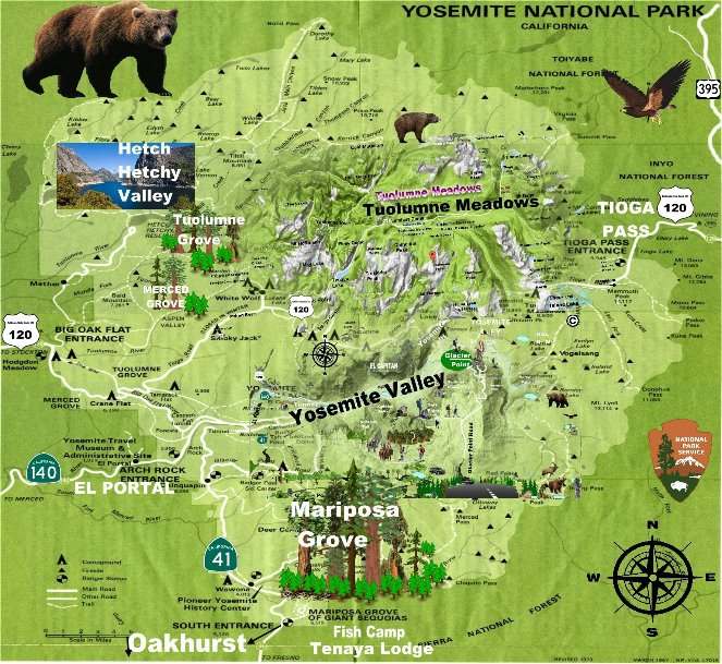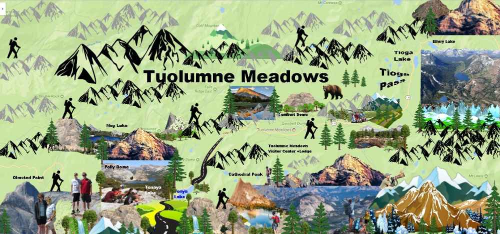


Yosemite Valley Outdoor Activities & Day Hikes
 The Yosemite Valley is carved deep into the gently sloping western flank of the western part of the Sierra Nevada, and characterized by its ‘U’ shape. However, the Valley was ‘V’ shape until the Ice Age when geological forces started pushing the hills and mountains higher and higher, and the Merced River flowed more quickly and violently through the Yosemite Valley. The Ice ages caused major changes to the valleys and landforms, as glaciers of 2,000 feet thick flowed through the valley, these glaciers carved away the bottom of the valley from a ‘V’ to the broader ‘U’-shape as seen today.
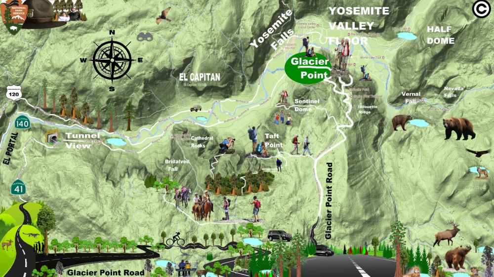
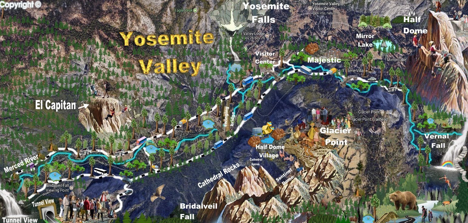
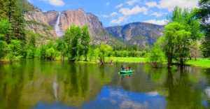
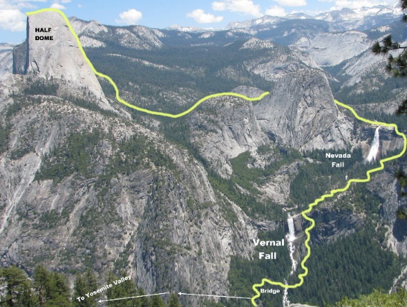
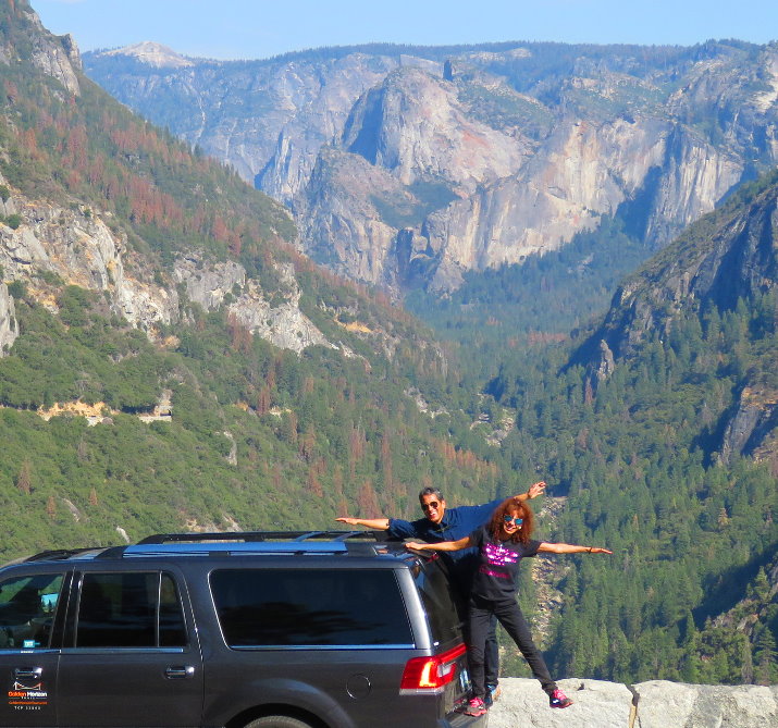
Today, the Yosemite Valley offers visitors unique views of towering cliffs, spectacular waterfalls and the beautiful Alpine scenery. Marvel in awe at Yosemite’s natural wonders, which include waterfalls, granite-polished domes and hanging rocks such El Capitan, Cathedral rocks, and Half Dome. There are also many other sights and attractions to see in Yosemite Valley including museums, visitor centers and much more. But the number one activity is hiking. Half Dome is the top destination for avid hikers from all over the word.
 Half Dome is a well-known granite dome rock formation in the park at the eastern end of Yosemite Valley. It is named for its distinct shape. One side is a sheer face while the other three sides are smooth and round, making it appear like a dome cut in half. The granite crest rises more than 4,737 ft (1,444 m) above the valley floor.
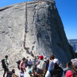
Half Dome is a very public climb ascended in several different ways. Thousands of hikers reach the top each year by following an 8.5 mi (13.7 km) trail from the valley floor. After a rigorous 2 mi (3.2 km) approach, including several hundred feet of granite stairs, the final pitch up the peak’s steep but somewhat rounded east face is ascended by hikers with the aid of a pair of post-mounted braided steel cables originally constructed close to the Anderson route in 1919.
Most hikers take about 12 hours to hike all the way up Half Dome and back; some hikers take even longer. Park visitors have to get up extremely early and be in good physical condition because this is a very challenging hike and some hikers die in Yosemite each year. Although very few fatalities are on Half Dome, many accidents have been reported. From 1919 when the cables were erected through 2011, there have been six fatal falls from the cables. The latest fatality occurred on July 31, 2011. Lightning strikes can also be a high risk while on or near the summit. On July 27, 1985, five hikers were struck by lightning, resulting in two fatalities.
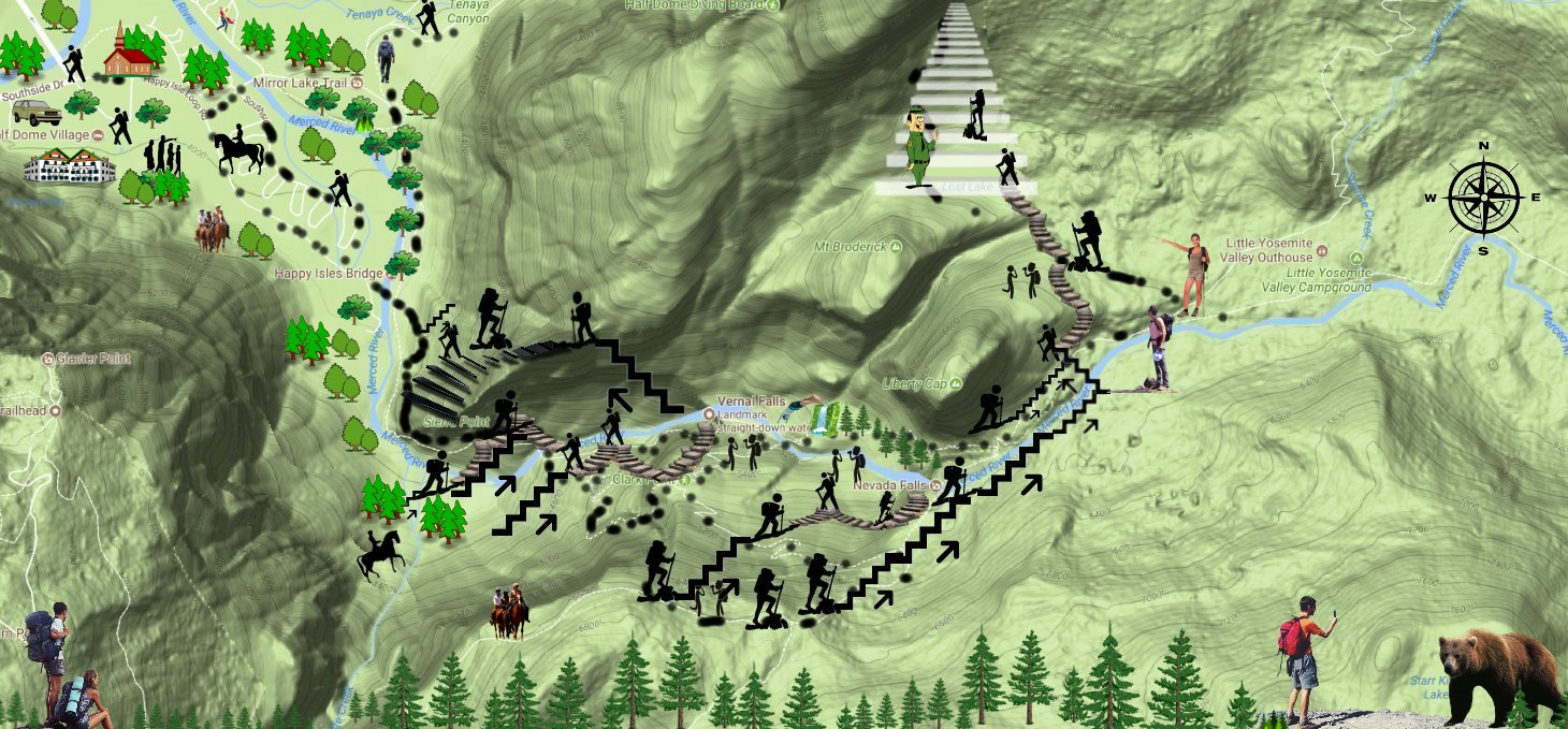
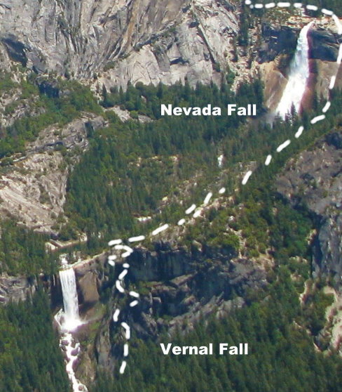
The Half Dome Cable Route hike runs from the valley floor to the top of the dome in 8.2 mi (13 km) (via the Mist Trail), with 4,800 ft (1,460 m) of elevation gain. The hike can be done from the valley floor in a single long day, but many people break it up by camping overnight in Little Yosemite Valley. The trail climbs past Vernal and Nevada Falls, then continues into Little Yosemite Valley, then north to the base of the northeast ridge of Half Dome itself. The final 400 ft (120 m) ascent is steeply up the rock between two steel cables used as handholds.
Since 2011, all hikers who intend to ascend the Cable Route must now obtain permits before entering the park. Permits are checked by a ranger on the trail, and no hikers without permits are allowed to hike beyond the base of the sub-dome or to the bottom of the cables. Hikers caught bypassing the rangers to visit either the sub-dome or main dome without a permit face fines of up to $5,000 and/or 6 months in jail.
On March 28, 2009, a large rock slide of 1,500,000 cubic feet (42,000 m3) occurred from Ahwiyah Point. The slide happened at 5:25 a.m. and damaged a large area under the dome. No one was injured, but hundreds of trees were knocked down, and a portion of the Mirror Lake trail was buried. The slide registered on seismographs as an earthquake reaching 2.5 on the Richter Scale.
In 2009, a large rock-slide of 1,500,000 cubic feet (42,000 m3) occurred from Ahwiyah Point. The slide happened at 5:25 am and damaged a large area under the Dome. No one was injured, but hundreds of trees were knocked down, and a portion of the Mirror Lake trail was buried. The slide registered on seismographs as an earthquake reaching 2.5 on the Richter Scale.
Certain attractions and roads are seasonal and may not be accessible to vehicles during the winter time due to heavy snow falls. Private custom tours by 4×4 SUV are highly recommended.